Introduction
Synthetic Aperture Radar
Synthetic aperture radar(SAR) is a form of radar that is used to create images of objects, such
as landscapes- these images can be either two or three dimensional representations of the
object.
→ The remote sensing which is carried out in the microwave region of the electromagnetic
spectrum
is known as microwave remote sensing.
→ SAR remote sensing is an imaging active microwave remote sensing technique which provides
higher spatial resolution data.
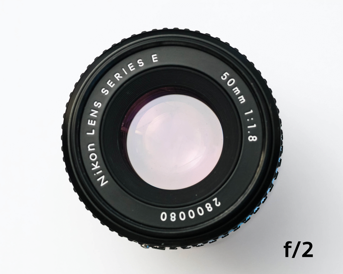
Aperture of the lens is the hole inside the lens through which the light reaches the image
sensor inside the camera.
That is, the area of that sensor through which the light is passing and reaching that
sensor.
The smaller the aperture, the less light will be able to reach the sensor.
and the image will become dark.
But if the aperture is large then light will also reach the sensor more and the picture will
become bright and clear.
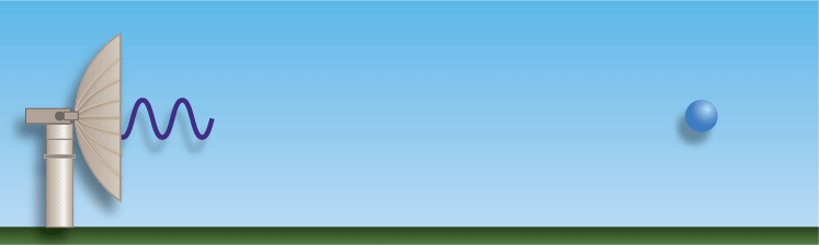
The radar propagates the waves and then observes the waves which collide back.
By which we can measure the distance, speed and size of any object.
The specialty of the radar used in synthetic aperture radar is that it uses microwaves.
Because of this, it can scan the picture at night and even across the clouds.
This radar works well in both day and night but normal optical radar does not work well at
night.
Sar is independent of flight altitude, In other words IT can scan clear images in any
weather as it can change its
frequencies accordingly.
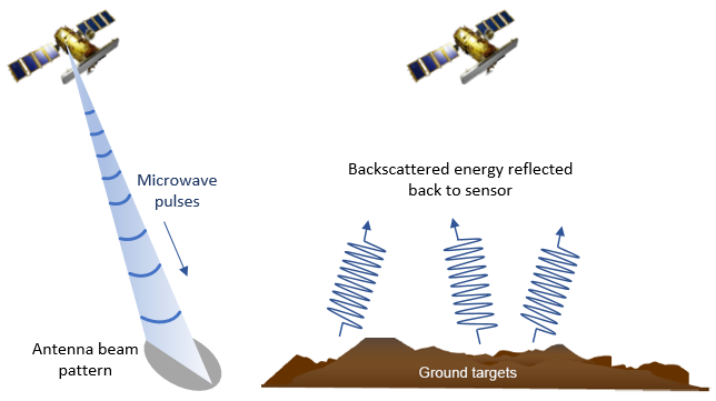
A synthetic aperture radar (SAR) is an active sensor that first transmits microwave signals
and then receives back the signals that are returned, or backscattered , from the Earth's
surface.
SAR is usually mounted on a moving platform, such as an aircraft or spacecraft,
and when it moves forward it scans targeted location.
sar gets images due to motion of its antena,here we do not use antenna physically but its
motion because of it is known as synthetic aperture
radar.
This radar captures many simple scanned images so that we get a clear and good
picture. Which gets cleared due to repeated scanning, sar uses different types of microwaves
waves. Like x band type p
type band etc.
SAR data can also enable an analysis method called interferometry, or InSAR. InSAR uses the
phase,information recorded
by the sensor to measure the distance from the sensor to the target.
For more detailed information on Working Click
Here
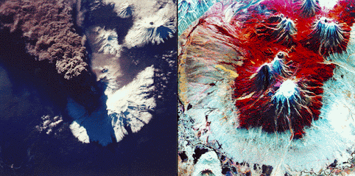
With the help of sar we can check conditions of the volcano. And get to know early when it
will explode.
SAR can show us the activities going in dense forest and it also can tell us about the
health of forest.
As we can see SAR is important due to which two big space organisations NASA
and ISRO are collaborating on a project called NISAR.
For more Applications Click Here